

September 26, 2026
Lake Rosalie, Lake Wales: The 1947 Canal That Gave the Lake a Second Way Out
Water leaves Lake Rosalie in two directions at once, and the northern route — the Zipprer Canal that kayakers now paddle — was cut through a floodplain marsh in 1947 to drain it for cattle pasture
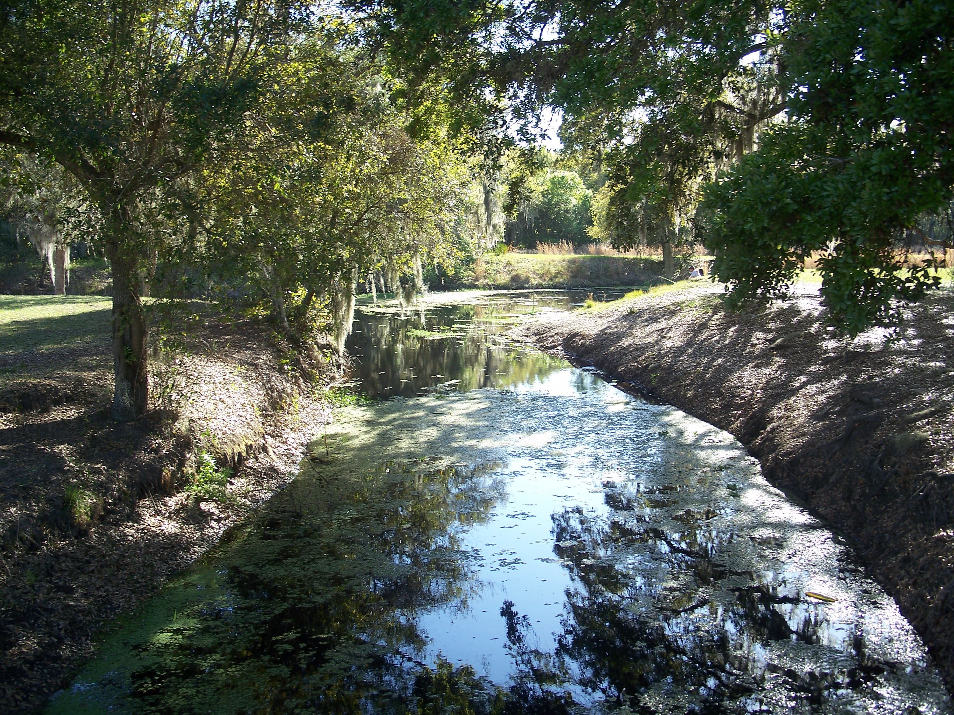
Water leaves Lake Rosalie in two directions at once. The USGS gage on the lake's west side, 10.5 miles northeast of Lake Wales, records it plainly: outflow goes through a diversion canal to Lake Kissimmee, and also through Rosalie Creek to Tiger Lake, and from there through Tiger Creek to Lake Kissimmee. One of those routes is the lake's own. The other was dug in 1947 to give cattle more grass.
The Army Corps of Engineers description of the Lake Rosalie control structure calls Rosalie Creek the natural outlet — a meandering stream at the south end of the lake that discharges into Tiger Lake, with a natural sill at elevation 50.0. Water had a northern path too, across a floodplain marsh called Rosalie Drain on the north side of Buster Island. The state park's management plan records that the majority of the flow went the long southern way, and that the northern route functioned during high water times. Lake Kissimmee's surface sits four feet below Lake Rosalie's and one foot below Tiger Lake's.
Before 1947, according to the Florida Department of Environmental Protection's approved management plan for Lake Kissimmee State Park, Rosalie Drain was a seasonally inundated open floodplain marsh that gradually released water to Lake Kissimmee. That year a canal was dug through the drain to connect Lake Rosalie and Lake Kissimmee, to expedite runoff from the drain and create more grazing area for cattle. The plan calls that cut the Zipprer Canal.
The drain dried out. DEP's plan traces the hardwood and pine invasion of Rosalie Drain directly to that increased drainage, and describes wax myrtle moving into floodplain marshes across the park as their hydrology was disrupted.
In 1979 a weir was built on the Zipprer Canal to hold some water back and approximate historic water levels in Rosalie Drain. It worked in part. The plan records that reflooding the drain reduced the hardwood invasion, that maidencane is now dominant, and that wax myrtle is absent over a good portion of the marsh. The same plan records the limits: much of the water simply flows out the west end of the canal into Lake Rosalie, levels have still not reached their historic highs, and inundation has not lasted long enough. The plan's stated long-term aim for the canal is to restore it to floodplain marsh, while conceding that is likely not possible, because the South Florida Water Management District operates the canal for flood protection of the development around Lake Rosalie.
On April 30, 2015, the district put out notice that water levels in Lake Rosalie would decline at times while its engineers evaluated repair options for the aging G-103 weir, and that several water control boards had already been removed to relieve pressure on the structure.
In November 2015, paddlers gathered at Lake Kissimmee State Park to open the Buster Island Loop — eleven miles, the 53rd state-designated paddling trail in Florida and only the second in Polk County, said Liz Sparks, paddling trail coordinator for the state's Office of Greenways and Trails. The route takes paddlers up the Zipprer Canal into Lake Rosalie, out the lake's natural outlet down Rosalie Creek to Tiger Lake, down Tiger Creek to Lake Kissimmee, and back along another section of canal to the park marina. Bill Redmon, a veteran local paddler at the opening, described Rosalie Creek as a "wild, moving, enjoyable run."
DEP's guide for the trail recommends running the loop counter-clockwise, starting west on the canal, because of the currents that can build on Rosalie Creek, and warns paddlers to watch for airboats on Tiger Creek, which have limited vision around blind corners. The launch is beside the road bridge to the park's 1876-era cow camp, a short distance from the marina parking lot. Motorized boats are not allowed in the canal west of the weir, and the park keeps a wire gate at the canal's beginning, at Lake Rosalie.
Sources
Every factual claim in this story was checked against the page it came from before the story was saved. These are those pages. Our standards are on the masthead.
- USGS 02268600 Lake Rosalie near Lake Wales, FL — station description and remarks
- Lake Rosalie Control Structure G-103 (U.S. Army Corps of Engineers, Jacksonville District)
- Lake Kissimmee State Park Approved Unit Management Plan (Florida DEP, July 7, 2014)
- Lake Rosalie Water Levels May Fluctuate During Weir Work (South Florida Water Management District media advisory, April 30, 2015)
- New Buster Island Loop Paddling Trailing opens at Lake Kissimmee State Park, Tom Palmer, The Ledger, Nov. 15, 2015
- Buster Island Loop Paddling Trail Guide (Florida DEP, Office of Greenways and Trails)
Presented by

Own waterfront in Lake Wales?
Lake history is interesting. Shoreline conditions are practical. Horizon Marine builds docks, seawalls, and shoreline protection on Lake Wales's lakes — and gives a straight answer on what your property actually needs.
North Prong Alafia River, Mulberry: The 154 Snook That Started the Repair
When 1997's acid spill came down Skinned Sapling Creek into the North Prong, the first act of repair on the Alafia was a release of exactly 154 juvenile snook
Read →
Edward Medard Reservoir, Plant City: The Drawdown That Fed the Food Banks
When Hillsborough County's busiest reservoir was emptied in 2009 to rebuild its eroding bank, more than 1,300 of the stranded tilapia and catfish were filleted and sent to local food banks
Read →
Lake Otis, Winter Haven: The Two Parking Spaces That Unlocked the Hydrilla Money
Homeowners on a private Winter Haven lake raised about $40,000 to kill their hydrilla and needed $90,000 — so they built a public boat ramp instead, because a state rule only funds weed control on water the public can launch on
Read →
Lake Mattie, Auburndale: The Lake Florida Measures Other Lakes Against
Lake Mattie is one of the 71 lakes Florida uses as a reference for what a minimally disturbed lake looks like — and in 2019 the state's own update listed it at a Lake Vegetation Index score of 41 and asked whether it still qualified
Read →
Building on Lake Rosalie or another Lake Wales lake?
Free waterfront assessment · License #SCC131154313