

May 16, 2026
Lake Hollingsworth, Lakeland: The Three-Mile Loop That Made a National List
A 354-acre lake in central Lakeland ended up on a national top-20 list of running routes — and the reasons it earned that spot are baked into the shoreline itself
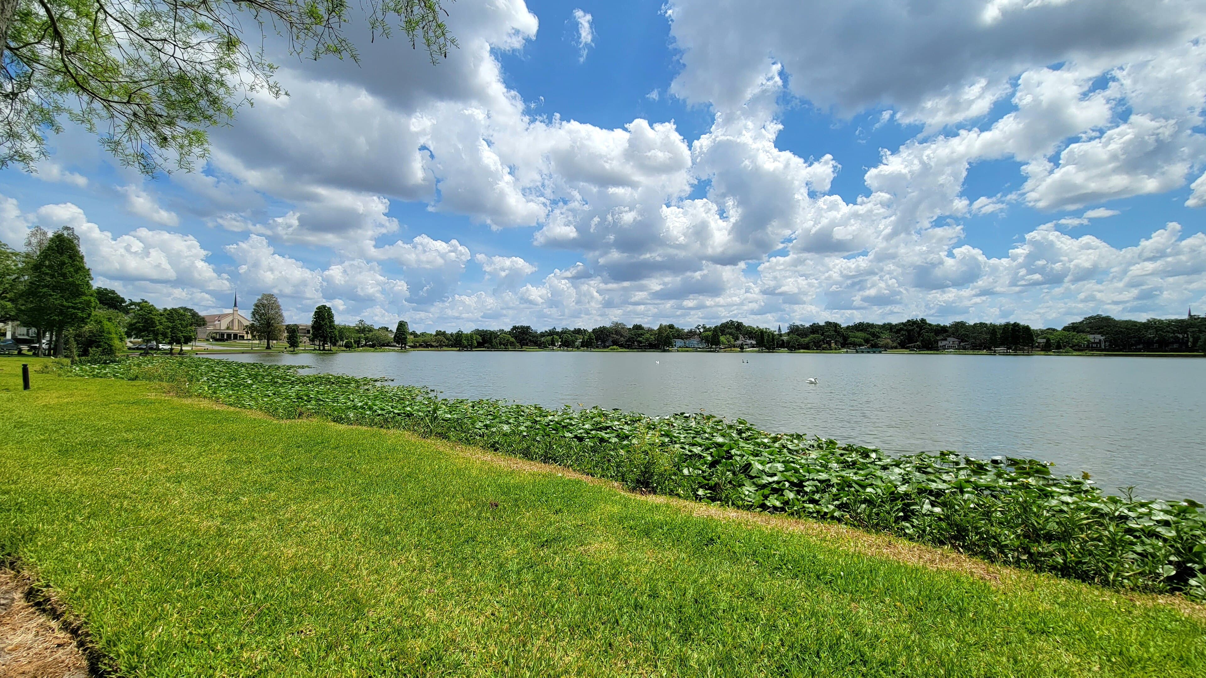
In 2017, Under Armour's MapMyRun service crunched its data on the country's most popular running routes and ranked Lake Hollingsworth in Lakeland at No. 20 in the United States. Not in Florida. In the country. A 354-acre lake tucked between Florida Southern College and the Cleveland Heights neighborhood, outpacing the marquee waterfronts of cities ten times Lakeland's size.
If you've ever pulled into the lot at the south end on a January morning, the ranking stops being surprising. By 7 a.m. the path is a moving belt of people — strollers, retired walkers in pairs, college kids putting in slow miles, the serious runners doing repeats, a few cyclists threading the gaps. By sunset it fills up again. The loop is roughly three miles. It is flat. It is continuous. It never crosses a major intersection. And almost every step of it sits within a few yards of the water.
That last part is the quiet engineering behind the popularity. Most urban lakes in Florida have been chopped up by private shoreline — docks, seawalls, backyards that run to the water's edge, with a public path squeezed somewhere inland behind a hedge. Hollingsworth went the other way. The first road around the lake existed by 1913, according to local histories, and the modern Lake Hollingsworth Drive that succeeded it kept the shoreline on the public side. The houses sit across the street. The path, the road, and the lake stack up in that order the whole way around. You are never looking at someone's pool screen. You are looking at water.
The shape helps too. Hollingsworth is close to round, with no peninsulas to detour around and no inlets long enough to force the path inland. Three miles of loop, and the far shore stays in view from almost every point. Runners can pace themselves against landmarks across the water — the bell tower at Florida Southern, the boathouse, the Cleveland Heights clubhouse — in a way that doesn't work on a linear trail.
And then there is the view across. Florida Southern College occupies the north shore, and its campus holds the largest single-site collection of Frank Lloyd Wright architecture in the world — twelve structures Wright designed beginning in 1938, built largely by student labor over the following two decades. From the south side of the lake at the right hour, the low horizontal lines of the Annie Pfeiffer Chapel and the Esplanades read across the water as a single composition. Most people on the path are not thinking about Wright. They are thinking about their splits, or the heron in the shallows, or whether they have time for another loop. But the architecture is doing work anyway. It gives the eye somewhere to land.
The lake itself is non-motorized — a rule that keeps the surface quiet enough to hear your own footfalls and the wading birds working the edges. Purple Gallinules are common on the southeast corner, comfortable enough around people that you can walk past one at conversational distance. The Florida Birding Trail lists Hollingsworth as a stop for exactly this reason: the boardwalks and paved perimeter let casual visitors see species that usually require a kayak.
None of which means the lake is in perfect shape. Hollingsworth has been the subject of a long sequence of water-quality projects — the Southwest Florida Water Management District and the City of Lakeland built stormwater treatment wetlands on the west side beginning in 2006, and a biosorption activated media unit was added to the existing pollutant control device in 2023 to pull soluble nutrients out of stormwater before it reaches the lake. Fish kills still happen; hundreds of dead gizzard shad turned up just this month and prompted an FWC investigation. The lake the runners circle is a working urban water body, not a postcard.
But the loop itself — the thing that put a mid-sized Florida city on a national running map — is the product of a century of decisions that mostly went the right way. Keep the shoreline public. Pave a path wide enough for walkers and cyclists. Don't let motorboats churn it up. Plant the trees that now shade most of the eastern stretch by mid-morning. Add a college with a Wright campus on the far bank, because why not.
Next time you're out there at sunrise and the path is already full, count the people you pass in a single loop. Then remember that someone with a database in Baltimore once added up everyone doing the same thing, across every city in America, and decided this lake belonged in the top twenty.
Presented by
Lake Harris, Tavares: The Day the College Record Fell
In January 2022, two brothers fishing a college tournament on Lake Harris brought a five-bass limit to the scales that weighed more than any single-day catch in the history of the Bassmaster College Series
Read →
Lake Silver, Winter Haven: When the Ferris Wheel Turned Above the Shore
For a few weeks each winter in the 1940s and '50s, a double Ferris wheel turned above the shoreline and the lake sat at the center of a national broadcast
Read →
Lake Clinch, Frostproof: The Thirty-Foot Serpent and the Town That Kept Seeing It
For more than a century, people on the Frostproof shore have been reporting a thirty-foot serpent in Lake Clinch — and the tradition is older than the town itself
Read →
Lake Hartridge, Winter Haven: The Afternoon Two Planes Came Down
On a clear March afternoon in 2023, two small planes collided over Lake Hartridge and went into the water within sight of the runway they'd just left
Read →
Have a waterfront project in Central Florida?
Free waterfront assessment · License #SCC131154313
(863) 934-6218
