September 22, 2026
Peace River, Fort Meade: The Thirteen Miles Where the River Drains Into the Ground
Between Bartow and Fort Meade the Peace River loses water into holes in its own bed — on one day in June 2002 the USGS measured about 32 million gallons going into the ground — and Fort Meade is where the leaking stops
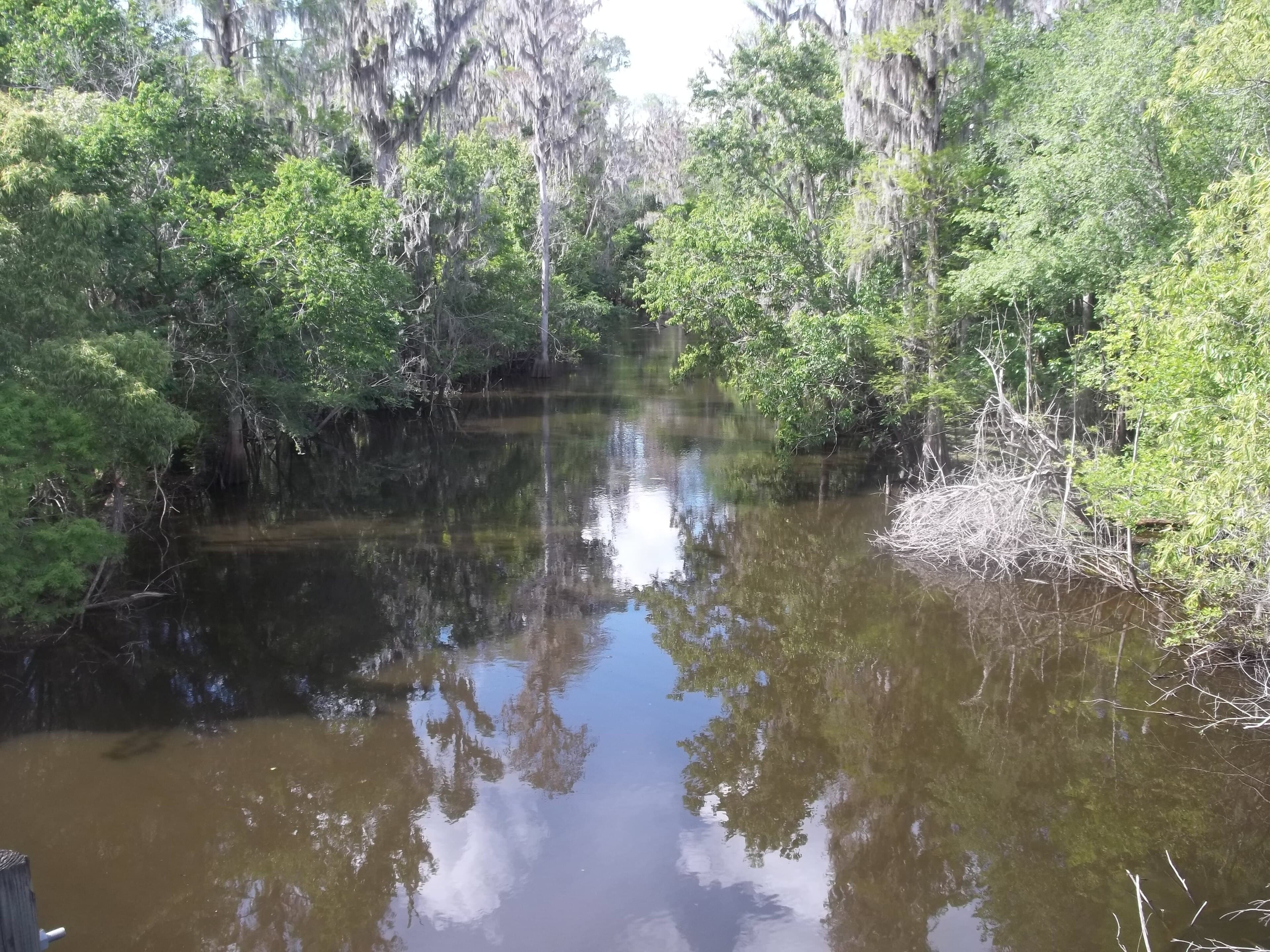
On June 28, 2002, hydrologists on the upper Peace River measured about 50 cubic feet per second leaving the channel — roughly 32 million gallons a day — into the ground underneath it. That was the largest loss the U.S. Geological Survey recorded from the karst features in the riverbed between Bartow and Fort Meade in a set of measurements that ran from 2002 through 2007.
The holes have names. In mid-May 2002, during a period with no surface flow at all, USGS crews working with the Southwest Florida Water Management District went into the dry channel and documented what was down there: the Fricano fracture, a coalescing group of vertical pipes; Midway sink, a collapsing sinkhole with small fractures near its base; Dover sink, at the base of an outcrop at the end of a 1,200-foot tributary in the floodplain; and a set of crevasses. About ten prominent karst features sit in a two-mile section beginning roughly a mile south of the Peace River at Bartow gaging station. Measured losses from the individual features ran from 0.22 to 16 cubic feet per second. The cavern system tied to Dover Sink can take in more than 10 million gallons a day on its own before the storage below it fills and the level in the sink steadies.
The USGS describes the reach from Bartow to Fort Meade as a groundwater recharge area — a reversal of the groundwater discharge pattern that existed there before the 1950s. Groundwater use in the upper part of the watershed contributed to the loss of flow between the two towns. With the gradient turned around, water in the channel goes down through the fractures and sinks into the aquifers below, and the largest losses during the USGS study came at the start of the summer rainy season, when flow picked up and large volumes went into replenishing cavities and void spaces underground that had been left unfilled.
Fort Meade is where it stops. South of Fort Meade the river is well-confined by the underlying aquifers, which prevents significant river flow losses to groundwater, a point the district's minimum-flows report sets out among the assumptions behind its hydraulic model of the reach. The gage record shows the line. In 2007 the gage at Clear Springs, between Bartow and Fort Meade, logged 260 days of zero flow. The Fort Meade gage, downstream, logged none — not one zero-flow day in any year from 2003 through 2022.
The two long-record gages give the size of the leak. From 1975 through 2022, flow at the Bartow gage exceeded flow at the Fort Meade gage on an average of 123 days a year, about a third of the year. The annual count ran from 26 days in 1989 to 263 days in 2000. Mean annual loss rates between the two gages topped 30 cubic feet per second in 20 of those years, and in 2004 they reached 332.
The dry-season fix sits at Lake Hancock, the largest freshwater lake in the Peace River watershed, upstream of where the river starts. The Lake Hancock Lake Levels Modification Project raised the lake's control elevation from 98.7 feet to 100 feet NGVD29 by reworking the P-11 water control structure at the lake outlet, so the lake could hold more wet-season water and release it slowly during the dry months into the upper river. Construction was finished in June 2015 and controlled releases to augment low flows began that December. Since the district began operating the modified structure in 2016, the upper Peace River has met its existing minimum low flow every year from 2020 through 2025.
On April 23, 2026, the district announced it was closing P-11 to hold Lake Hancock at its required minimum level, citing a 12.8-inch regional rainfall deficit against the average 12-month total. Without that discharge, the district said, portions of the upper Peace River from Lake Hancock to Fort Meade were expected to go dry and become non-navigable within days, and to stay dry until the rainy season began in June. Dry conditions on that stretch were common before 2015; since the project was completed the district had been able to keep water moving through every dry season but a short stretch of May 2017.
In June 2026 the district released a draft reevaluation of the minimum flows for the river from Bartow to Zolfo Springs. For the Fort Meade gage, it recommends a low-flow threshold of 21 cubic feet per second.
Sources
Every factual claim in this story was checked against the page it came from before the story was saved. These are those pages. Our standards are on the masthead.
- USGS Scientific Investigations Report 2009-5140: Hydrologic Conditions that Influence Streamflow Losses in a Karst Region of the Upper Peace River, Polk County, Florida
- A Reevaluation of Minimum Flows for the Upper Peace River from Bartow to Zolfo Springs, Florida (June 2026 draft), Southwest Florida Water Management District
- District Closing Lake Hancock Water Control Structure to Protect the Lake's Required Minimum Level, SWFWMD news release, April 23, 2026
- Restoration of the Peace River, Southwest Florida Water Management District
Presented by

Own waterfront in Fort Meade?
Lake history is interesting. Shoreline conditions are practical. Horizon Marine builds docks, seawalls, and shoreline protection on Fort Meade's lakes — and gives a straight answer on what your property actually needs.
Little Lake Harris, Howey-in-the-Hills: The Summer Nobody Could Get Off the Dock
In August 2018 hydrilla filled Little Lake Harris so thickly that people couldn't get a boat away from their own docks, and by November the state was treating 2,700 acres of a 2,744-acre lake
Read →
Lake Osceola, Winter Park: The Boat Tour That Outlasted Everything Else in Orlando
The narrow canals between Winter Park's lakes were dug for Gilded Age homeowners — and in 1938 they became the route for an attraction that has run longer than anything else in greater Orlando
Read →
Moon Lake, New Port Richey: The Foot and a Half That Doubles the Lake
Between 38.2 and 39.6 feet, Moon Lake grows from about 105 acres to 193 — the extra water standing in a 95-acre cypress swamp that a raised road cut off from the lake, and that now sets the lake's legal minimum level
Read →
Saddlebag Lake, Lake Wales: The Five Months of Pumping It Took to Get the Water Out
Saddlebag Lake is a closed basin with no outlet, so when it rose into 300 homes in 2005 the only way out was three pumps and two miles of pipe to Lake Rosalie — paid for by the residents at $30,000 a month
Read →
Building on Peace River or another Fort Meade lake?
Free waterfront assessment · License #SCC131154313