

September 27, 2026
Lake Whistler, Auburndale: The Dam on This Shore Belongs to the Lake Next Door
A high-hazard state dam completed in 1965 stands on 75-acre Lake Whistler's northeast shore, and the federal inventory lists its reservoir at 764 acres — Lake Arietta's number, not Whistler's
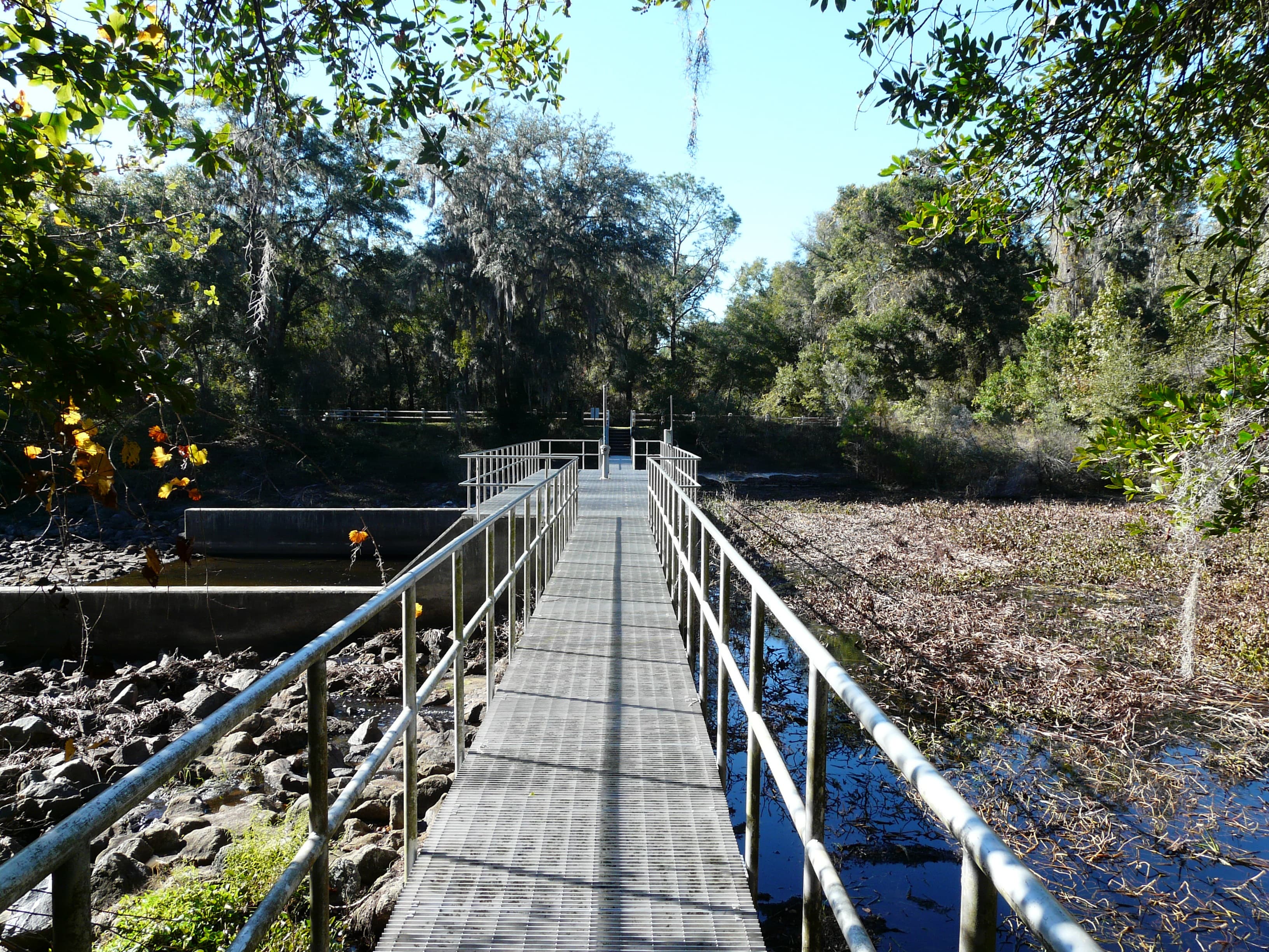
On the northeast shore of Lake Whistler, off Kirkland Lake Drive northwest of Auburndale, stands a concrete dam the national dam inventory tracks as FL12011. The entry calls it Structure P-3 and lists the Southwest Florida Water Management District as its owner. The year completed is 1965. Its hazard potential classification is High. For the surface area of the water it impounds, the inventory gives 764 acres.
Lake Whistler covers about 75 acres.
The 764 acres belong to Lake Arietta, on the other side of the berm. The inventory carries a second name for Structure P-3 — Lake Arietta — and puts its drainage area at 3.70 square miles. The U.S. Geological Survey lists 3.7 square miles for its Lake Arietta gauge and 4.33 for its Lake Whistler gauge. The water management district's own roster of Polk County water control structures names it the P-3 (Lake Arietta) Water Conservation Structure, located near the northeast shore of Whistler Lake, with the gate operated to help maintain water levels on Lake Arietta.
The district's daily water control structure report gives Lake Arietta an operational range of 140.1 to 143.1 feet NAVD88. Lake Whistler's entire measured range, from August 1984 through September 2026, runs 132.77 to 137.42 feet on the same datum. Arietta's operating floor sits above every level ever recorded on Whistler. What the gate lets go travels down a channel the dam inventory names the P-3 Canal, at a maximum discharge of 200 cubic feet per second.
Published accounts differ on which direction that runs. The Ledger, reporting the 2018 repair, described P-3 as regulating flow from the 75-acre Lake Whistler into the 754-acre Lake Arietta. The agency records put Arietta on the upstream side.
Water that passes the gate does not stop at Whistler. Florida's Department of Environmental Protection, assessing Lake Ariana in 2018, described that 1,030-acre lake as receiving water from Lakes Arietta and Whistler to the north and west, then discharging to Lake Lena through a canal 164 feet long at Ariana's south end. The department's 2015 report on Lake Lena carries the route the rest of the way: Lena's control structure at its southeastern end discharges into Lake Lena Run, which flows into Lake Hancock, and Hancock discharges to lower Saddle Creek, which along with the Peace Creek Drainage Canal makes up the headwaters of the Peace River.
The pipe under the berm was a culvert 42 inches wide and 70 feet long. The Ledger reported that it had been deteriorating over the decades, and that when Hurricane Irma came it started to collapse. The district's account of the damage was the same: during Irma the culvert began to show signs of rusting and started to collapse. On March 27, 2018, the district announced it would replace the rusty steel culvert with a new aluminum one of the same 42-inch width. Patrick Casey, the district's structure operations project manager, said the replacement would match the size of the old one.
Getting to it meant tearing into the berm that residents near Lake Whistler use to reach their homeowners association's boat ramp, and building a temporary dam around the structure to dry out the work area before the old culvert could be dug out. John Dickson, Auburndale's public works director, said the city would temporarily cap a water line running through the project, with no effect on flow to customers. Work began the first week of April and was scheduled to finish before the rainy season, which typically starts June 1. District staff monitored levels on both lakes while it went on.
The dam inventory now lists the condition of Structure P-3 as Satisfactory. In the district's daily water control structure report, the gate still appears under Table 16, the Lake Hancock Drainage Basin summary, and the waterbody named in that row is Lake Arietta.
Sources
Every factual claim in this story was checked against the page it came from before the story was saved. These are those pages. Our standards are on the masthead.
- Structure P-3 (Polk County, FL) — Dam Safety Inspection / National Inventory of Dams data
- Water Control Structures in Polk County — Southwest Florida Water Management District
- Lake Whistler Near Auburndale, FL — USGS monitoring location 02294300
- Lake Arietta Near Auburndale, FL — USGS monitoring location 02294298
- Water Control Structure Report — Southwest Florida Water Management District, Hydrologic Data Section
- Lake Whistler — Polk County Water Atlas
- Project to keep water flowing between Lake Arietta, Lake Whistler in Polk — The Ledger, March 29, 2018
- District Schedules Repairs to Water Conservation Structure in Polk County — SWFWMD news release, March 27, 2018
- Lake Ariana and Eagle Lake Nutrient TMDL Report — Florida Department of Environmental Protection, August 2018
- Nutrient TMDL for Lake Lena (WBID 1501) — Florida Department of Environmental Protection, March 2015
Presented by

Own waterfront in Auburndale?
Lake history is interesting. Shoreline conditions are practical. Horizon Marine builds docks, seawalls, and shoreline protection on Auburndale's lakes — and gives a straight answer on what your property actually needs.
Hardee Lakes, Bowling Green: The Lake That Stayed Closed Until the Fish Grew
Lake 3 at Hardee Lakes Park was stocked with sunshine bass in 2001 and then kept shut to anglers while they grew, and when it finally opened one Saturday morning in October 2005 all eight spots were already taken
Read →
Moon Lake, New Port Richey: The Foot and a Half That Doubles the Lake
Between 38.2 and 39.6 feet, Moon Lake grows from about 105 acres to 193 — the extra water standing in a 95-acre cypress swamp that a raised road cut off from the lake, and that now sets the lake's legal minimum level
Read →
Lake Elbert, Winter Haven: The Hillside That Was Meant to Be America's Largest Modernist Neighborhood
Ten glass-walled houses opened on the grapefruit-grove crest above Lake Elbert's east shore in March 1957, and 10,000 people walked through them that first weekend — the opening installment of a modernist development that stopped at ten.
Read →
Spring Lake, Brooksville: The Grove That Turned Into an Attraction
A hard freeze wiped out a Spring Lake citrus grower's living in the early 1960s, and rather than replant, the Boyett family turned the survivors into a roadside attraction that outlived the groves around it
Read →
Planning waterfront work in Auburndale?
Free waterfront assessment · License #SCC131154313