

September 17, 2026
Moon Lake, New Port Richey: The Foot and a Half That Doubles the Lake
Between 38.2 and 39.6 feet, Moon Lake grows from about 105 acres to 193 — the extra water standing in a 95-acre cypress swamp that a raised road cut off from the lake, and that now sets the lake's legal minimum level
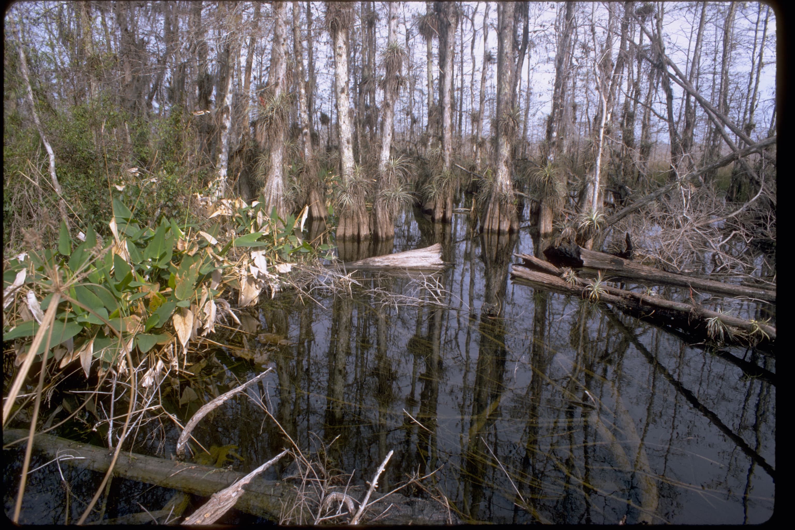
At 38.2 feet above sea level, Moon Lake covers about 105 acres. Raise it to 39.6 feet — a foot and a half of water — and the same maps put it at 193 acres. Almost all of that added surface sits east of the lake, in a cypress swamp.
The Southwest Florida Water Management District measured where the two meet and wrote the elevation down: 38.3 feet NGVD, the height of the main inflow culvert between Moon Lake and a cypress-dominated wetland of roughly 95 acres on the lake's east side. Below that mark they are two separate pieces of water. Above it they are one. Working from the gauge record between January 1965 and March 2015, District staff calculated that the lake and the cypress wetland are connected 49 percent of the time.
The culvert is there because a road is there. Reading historical imagery, the District found that a raised road was built between the lake and the wetland, and that the road reduced how often the two connect. Before it went in, the report says, a broader natural connection was likely in place, and the wetland and the lake likely formed one continuous basin. Water leaves at the other end through ditches and culverts that start along the south shore and run out through several wetland ponds toward the Pithlachascotee River, off a drainage area of 0.3 square miles. The county's boat ramp and swimming beach, maintained by Pasco County Parks and Recreation, sit on the northeastern shore.
Moon Lake has been gauged since January 1965, and the record holds a wide swing. Levels went above 41 feet in March 1998, during the El Niño period, and again in September and October of 2004, during that hurricane season. The extreme low, 32.9 feet, came on May 18, 2009. For comparison, the 1954 USGS Fivay quadrangle printed a water level of 41 feet for Moon Lake, and the Gazetteer of Florida Lakes listed the lake at 99 acres at that elevation.
The District places Moon Lake in the Weeki Wachee Hills lake region, described as Pleistocene sand dunes holding numerous solution basins with clear water, circumneutral pH, low alkalinity and low nutrient levels. The surrounding country is a plain of silty sand over Tampa Limestone. Limestone dissolves, and the hollows left behind fill.
Under District rules, a lake contiguous with at least half an acre of cypress-dominated wetland is a Category 1 lake, and its minimum level is set by the Cypress Standard — the elevation the cypress needs. For Moon Lake that elevation is 38.2 feet, and in a report dated June 17, 2015, Keith Kolasa and Jason Patterson of the District's Resource Evaluation Section recommended it as the revised Minimum Lake Level: the elevation the lake's water is required to equal or exceed fifty percent of the time on a long-term basis, and the point past which further withdrawals would be significantly harmful to the water resources of the area.
Nobody draws water off the surface of Moon Lake. The District permits no surface water withdrawals there. The withdrawals that reach the lake are underground, and they include Tampa Bay Water's Starkey and North Pasco wellfields. Using the Integrated Northern Tampa Bay model, District staff put the average predicted drawdown in the surficial aquifer near Moon Lake at 0.3 foot from 1989 to 2000 and 0.2 foot from 2000 forward — effects the report calls light, though enough that the agency built a water budget model to reconstruct what the lake would have done without them, back to 1946.
The proposed levels went to the neighborhood before they went to the Governing Board. A District news release dated June 21, 2015 announced a public workshop at 6 p.m. on Thursday, July 9, at the Regency Park Branch Library at 9701 Little Road in New Port Richey, where staff would review the technical basis for the proposed levels and take comment from local government and residents. Staff expected to present the levels to the Governing Board that August.
Based on available measured and modeled water level records, the District concluded, the revised minimum levels for Moon Lake are being met.
Sources
Every factual claim in this story was checked against the page it came from before the story was saved. These are those pages. Our standards are on the masthead.
Presented by

Own waterfront in Tampa?
Lake history is interesting. Shoreline conditions are practical. Horizon Marine builds docks, seawalls, and shoreline protection on Tampa's lakes — and gives a straight answer on what your property actually needs.
Hardee Lakes, Bowling Green: The County That Had No Lakes Until a Mine Made Four
Every one of Hardee County's four lakes was dug by a phosphate dragline in the 1990s — the county had no natural lakes at all until a worked-out mine was handed back as water
Read →
Lake Osceola, Winter Park: The Boat Tour That Outlasted Everything Else in Orlando
The narrow canals between Winter Park's lakes were dug for Gilded Age homeowners — and in 1938 they became the route for an attraction that has run longer than anything else in greater Orlando
Read →
Lake John, Lakeland: The Lake a Dragline Left Behind
The 99-acre lake behind the ballfields at Curtis Peterson Park in Lakeland wasn't shaped by any river — it's water sitting in ground a phosphate dragline emptied out in the 1950s
Read →
Lake Denton, Avon Park: The 51-Foot Hole Where Divers Certify
A shallow-state lake that drops to 51 feet with 30 to 40 feet of visibility became one of inland Florida's go-to lakes for learning to scuba dive
Read →
Planning waterfront work in Tampa?
Free waterfront assessment · License #SCC131154313