September 14, 2026
Lake Tracy, Haines City: The Ditch That Got Its Own Government
A drainage ditch that begins at the north end of Lake Tracy has had its own unit of Florida government since 1929, and it still assesses $50 an acre to keep the channel open
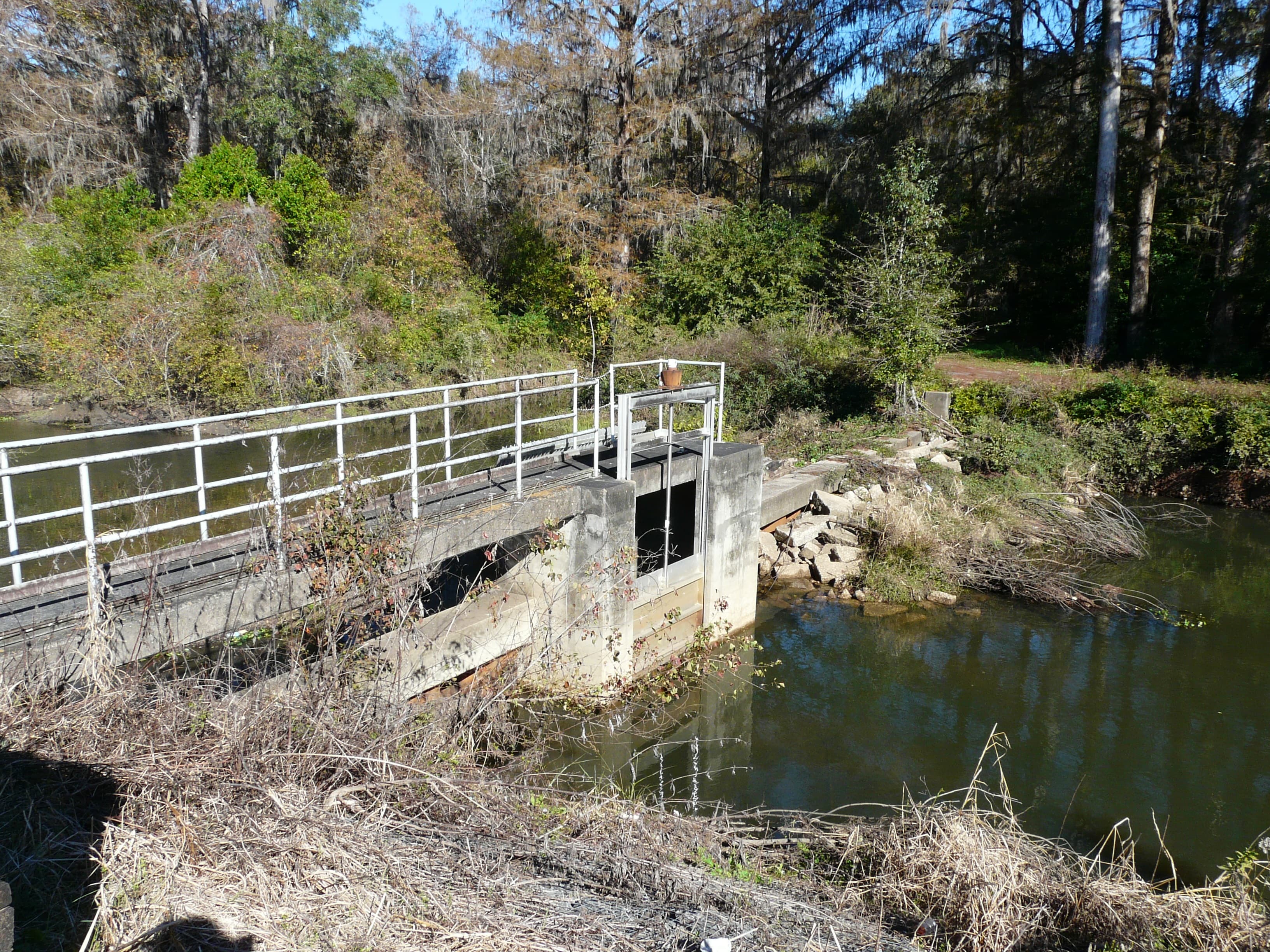
There is a unit of Florida government whose entire reason for existing is a ditch, and the ditch begins at the north end of Lake Tracy.
The Legislature created it in 1929, and it took two acts to do it. Chapters 13649 and 14517, Laws of Florida, together established Haines City Drainage District Number 1, covering a defined area on the western side of the Haines City corporate limits in Polk County. It was organized around a channel that meanders southerly along both the east and west sides of what is now U.S. Highway 27.
Ninety-seven years later the district is still in operation. It goes by Haines City Water Control District now, works under Chapter 2004-402, Laws of Florida, and under Chapters 189 and 298 of the Florida Statutes, and is run by a five-member board of supervisors. The job description has not broadened much since 1929: keep the ditch free of vegetation and anything else that restricts water draining into it from the adjoining uplands, and monitor development along or near the ditch that might affect the flow and discharge of water along it.
From the north end of Lake Tracy the ditch extends northerly and westerly, crosses to the west side of U.S. 27, then runs southerly, generally parallel with the highway, to a point where it crosses back to the east side. At the south end, below County Road 544, it bends southwest, passes under U.S. 27 a second time, and ends at an outfall into Middle Lake Hamilton — which is joined by canal on its west side to Lake Hamilton, 2,142 acres of open water.
The district is older than the highway its ditch crosses twice. The American Association of State Highway Officials approved extending U.S. 27 south from Tallahassee toward Miami on June 23, 1948, and the route reached Miami the following year — nineteen years after the Legislature chartered the district, and with the understanding at the time that the stretch from Leesburg south to Sebring would run on temporary routes.
The maintenance is paid for by the acre. The district's proposed budget for fiscal year 2022–2023 rested on 2,772 acres across 1,280 parcels, assessed at $50 per acre or any portion of an acre, for an estimated $145,000 including a $5-per-parcel collection cost. The fiscal year runs October 1 to September 30, with a tentative budget presented to the supervisors in August and the final budget approved in September. Chapter 298 of the Florida Statutes, one of the laws the district still answers to, measures a landowner's say in acres — one vote for every acre of assessable land owned in the district, cast in person or by written proxy.
Haines City counted 26,669 residents at the 2020 census, up more than a third from 2010. In 2021 the Southwest Florida Water Management District presented preliminary flood-prone area information for the Haines City watershed at a virtual public meeting and asked residents to help identify problem spots — a study funded by the water management district and the City of Haines City, intended for local floodplain management rather than for FEMA's flood insurance rate maps, though it may be used in future map updates.
Lake Tracy covers 100 acres, sits in the Peace River–Peace Creek Canal watershed, and carries the state water body identifier WBID 14921. Haines City keeps a small park on its shore at 123 McKay Drive with a paved public boat ramp and a grass area for trailer parking.
On June 29, 2026, at 5 p.m., the supervisors met in the offices of the Haines City Community Redevelopment Agency at 303 Ledwith Avenue to take public comment on the coming year's non-ad valorem assessments. The rate is still $50 an acre, or any portion of one.
Sources
Every factual claim in this story was checked against the page it came from before the story was saved. These are those pages. Our standards are on the masthead.
- About the Haines City Water Control District
- Revenue Information - The Haines City Water Control District
- Preliminary Budget Fiscal Year 2022-2023 - Haines City Water Control District
- Board Meetings - The Haines City Water Control District
- Chapter 298, 2023 Florida Statutes - Drainage and Water Control
- Lake Tracy - Polk County Water Atlas
- Middle Lake Hamilton - Polk County Water Atlas
- Lake Hamilton - Polk County Water Atlas
- U.S. Route 27 in Florida - AARoads Wiki
- Haines City, FL Population by Year - Neilsberg
- Haines City Floodplain Meeting - WaterMatters.org (SWFWMD)
- Public Invited to Help Identify Flood Prone Areas in the Haines City Watershed in Polk County (2021) - SWFWMD
- Lake Tracy Boat Ramp Park | Haines City, FL
Presented by

Own waterfront in Haines City?
Lake history is interesting. Shoreline conditions are practical. Horizon Marine builds docks, seawalls, and shoreline protection on Haines City's lakes — and gives a straight answer on what your property actually needs.
Moon Lake, New Port Richey: The Foot and a Half That Doubles the Lake
Between 38.2 and 39.6 feet, Moon Lake grows from about 105 acres to 193 — the extra water standing in a 95-acre cypress swamp that a raised road cut off from the lake, and that now sets the lake's legal minimum level
Read →
Edward Medard Reservoir, Plant City: The Mine That Became the Park
The 770-acre lake east of Brandon where a quarter-million people a year come to fish and camp was, in the 1960s, an open phosphate pit
Read →
Moon Lake, New Port Richey: The Four Miles of Roses in the Pine Flats
In the 1930s a Clearwater hotel man ringed a Pasco County lake with 35,000 rose bushes and four miles of blooms, and drew Rex Beach and a Vanderbilt to a dude ranch in the pine flats
Read →
Lake June-in-Winter, Lake Placid: The Bird That Lives Only on the Sand
On the sand of the Lake Wales Ridge above Lake June-in-Winter lives a bird found nowhere else on Earth — and the scrub it depends on only survives because fire keeps clearing it
Read →
Planning waterfront work in Haines City?
Free waterfront assessment · License #SCC131154313